
Search
Summary 
Loading AI-generated summary based on World History Encyclopedia articles ...
Search Results
Definition
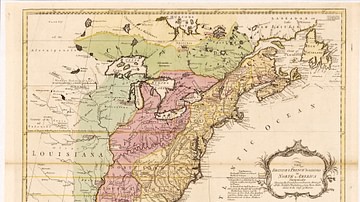
Middle and Southern English Colonies
The establishment of the Middle and Southern English Colonies of North America was encouraged by the earlier English settlements of Jamestown Colony of Virginia in the south (founded 1607) and Plymouth Colony and, especially, Massachusetts...
Article
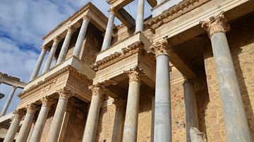
Top 5 Roman Sites in Southern Spain
Almost 700 years of continuous Roman occupation have left impressive traces in the Spanish landscape. Spain was then known as 'Hispania' and is now a fascinating location for the archaeological traveller. The Spanish provinces were amongst...
Image
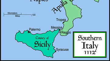
Southern Italy & Sicily, 1112
Political map of southern Italy c. 1112, showing the extent of the kingdom in 1154 upon Roger II of Sicily's death.

Image
Southern Octagonal Hall, Kofukuji
The Southern Octagonal Hall (Nanendo) of the Buddhist Kofukuji temple complex in Nara, Japan. First built in 813 CE but with the present version dating to 1741 CE.
Image
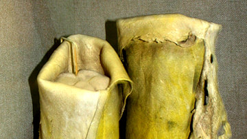
Southern Arapaho Woman's Leggings and Moccasins
Southern Arapaho woman's beaded buckskin leggings and attached moccasins, c. 1910.
Oklahoma History Center.
Photograph by Uyvsdi, 2009.

Image
Southern Defensive Walls in Bellinzona
This is a view of the southern city walls in the Swiss city of Bellinzona. These walls and defensive structures lead up to the Montebello Castle. These structures were constructed initially by the Milanese in the 15th century CE.
Image
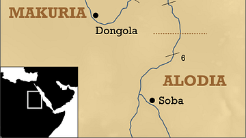
Southern Egypt/Nubia Map
A map indicating the location of the city of Faras, founded in 2040-1750 BCE and later a capital of Christian Nubia.
Image
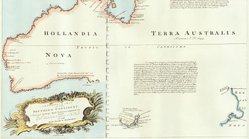
A Map of the Southern Continent
"A complete map of the Southern Continent surveyed by Captain Abel Tasman (1603-1659 CE) and depicted by order of the East India Company in Holland in the Stadt House at Amsterdam, 1774 CE." The map shows the western mainland of Australia...
Image
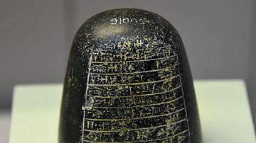
A One-mina Weight from Southern Mesopotamia
This is a diorite mina weight in the shape of a sugar loaf. The inscriptions state that this was a copy of a weight made for Nebuchadnezzar, following the standard of Shulgi, "The Old Sumerian King" (reigned 2094-2047 BCE). It was the property...
Image
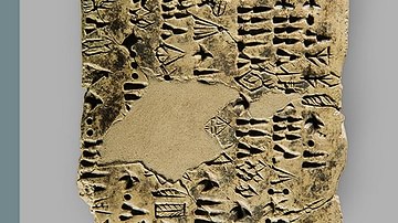
Early Elamite Clay Tablet with Numerical Signs from Southern Iran
Early Elamite clay tablet with numerical signs found in Tappeh Yahya, Kerman, dating to c. 3100 to 2900 BCE (Yahya Period IVc). National Museum of Iran, Tehran, inv. no. 4065. Photo by Nima Fakoorzadeh (Baloot Noghrei) Tappeh Yahya in...